Below are some of the research projects I have led in the past few years..
Do coupled megathrusts rupture?
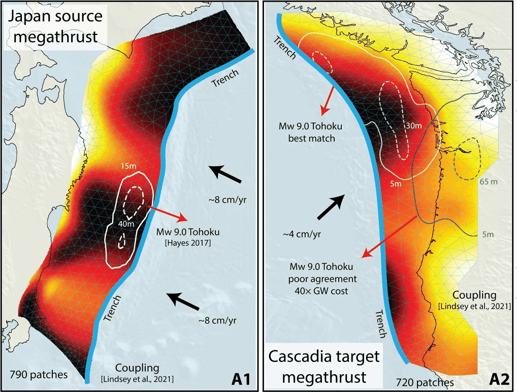
A central question in subduction-zone science is whether regions that are strongly interseismically coupled are the same regions that rupture during large earthquakes. Geodetic coupling is often interpreted as a proxy for where elastic strain is accumulating, but its predictive power for coseismic slip remains uncertain.
By comparing global earthquake slip distributions with interseismic coupling models across multiple subduction zones, I find that coupling contains information about rupture behavior, but the relationship is not one-to-one.
Coupling Cloud
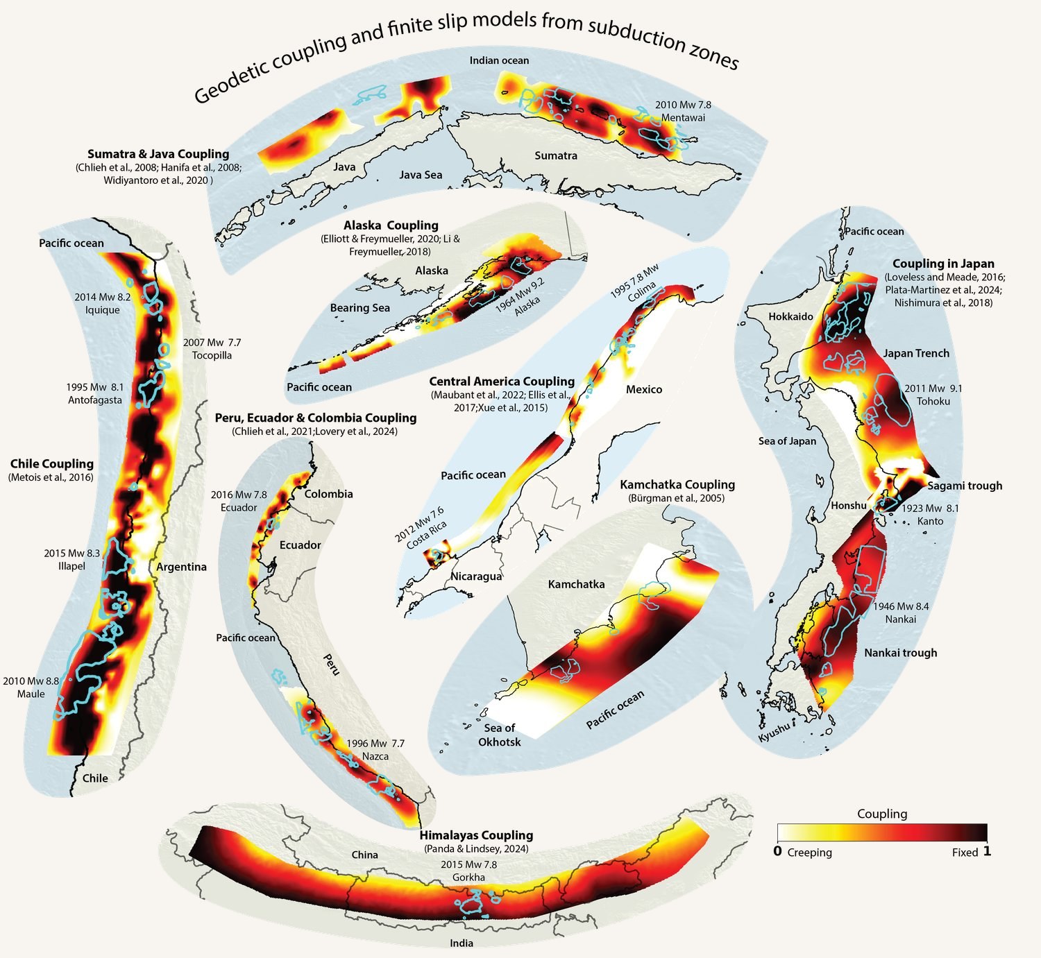
Published megathrust coupling models differ in geometry, resolution, parameterization, and format, making systematic comparisons difficult. I developed the Coupling Cloud, an open community database that standardizes published coupling models and makes them accessible for global analyses, earthquake-cycle modeling, and hazard applications.
The database provides the foundation for my work investigating how robustly interseismic coupling predicts subsequent earthquake slip.
Landscapes record long-term megathrust locking
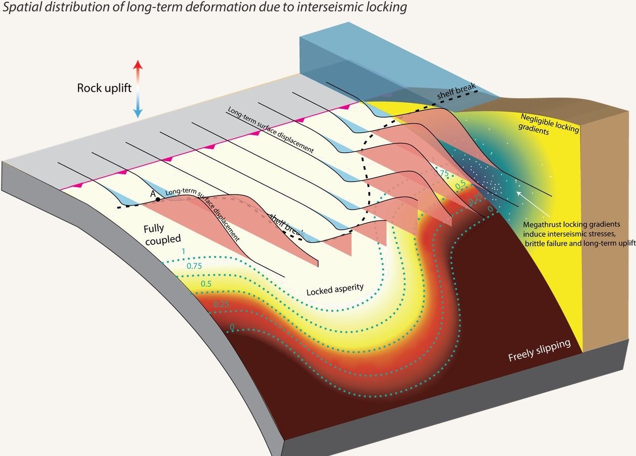
Geodetic observations span only decades, much shorter than typical megathrust recurrence intervals. I use forearc topography to investigate deformation over 104 to 106 years. In Megathrust locking encoded in subduction landscapes, I showed that spatial patterns of rock uplift recorded by river networks can preserve information about persistent megathrust locking.
This provides an independent constraint on fault behavior where geodetic observations are short or spatially incomplete.
Bayesian inversion of landscapes
Extracting tectonic deformation from river profiles is an inverse problem with substantial uncertainty. I developed a Bayesian framework that uses river-network geometry in χ-space to infer spatially variable rock uplift together with its posterior uncertainty.
This makes it possible to compare long-term geological deformation with present-day geodetic observations while explicitly accounting for how well each quantity is resolved.
Sequences of earthquakes and aseismic slip
I use Tandem, an open-source high-performance code for simulating sequences of earthquakes and aseismic slip, to investigate how stress and deformation evolve across repeated earthquake cycles. A major focus is understanding how megathrust loading and rupture interact with faults in the overriding plate.
I also contribute to the Tandem community and co-organized a SCEC workshop on Modeling the Earthquake Cycle from Faults to Supercomputers.
Indo-Burma and the Bengal Basin
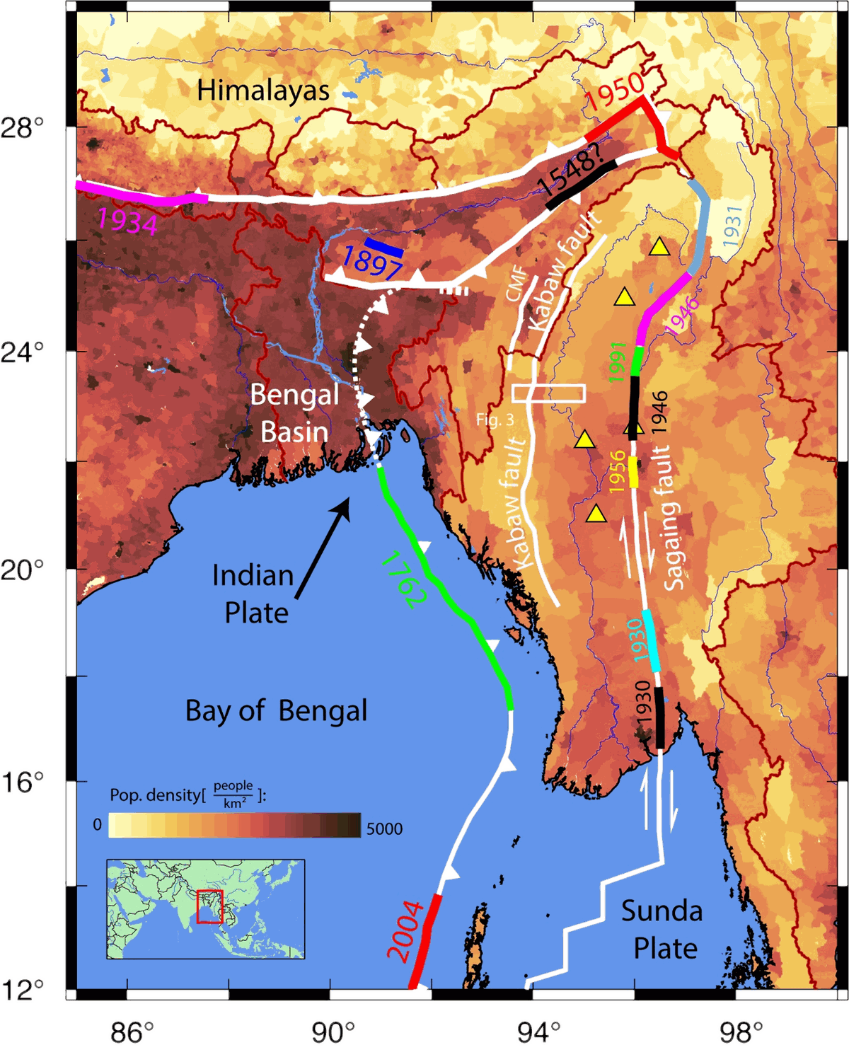
I study active deformation across the Indo-Burman subduction system using GNSS and geological observations. Our work showed that India-Sunda convergence is partitioned between a locked megathrust and the Kabaw Fault, with important implications for regional earthquake hazard.
Related projects use campaign GNSS to resolve interseismic deformation above the Rakhine-Bangladesh megathrust and to distinguish tectonic deformation from sediment compaction and subsidence across the Ganges-Brahmaputra Delta.
Optimal transport and machine learning
Our seismogeodetic record is fundamentally limited because each subduction zone has experienced only a handful of large earthquakes with modern geodetic observations. I am developing machine-learning and Gromov-Wasserstein optimal-transport methods that learn how earthquake ruptures can be transferred between mechanically similar subduction zones despite their different geometries. By combining observations from subduction zones worldwide into a unified framework, we can effectively increase the available seismogeodetic record and improve earthquake and tsunami hazard assessment in regions where great earthquakes are rare, such as Cascadia.